 NASA/JPL
Students will discover the greatest degree of slope in the broad Hellas basis is less than two degrees.
Hellas Planitia is the deepest basin on Mars. It is usually identified by a fuzzy, bright dust haze in the basin that strongly reflects sunlight. Locate Hellas Planitia (the bright, round region) on the Mars Observer image of Mars.
NASA/JPL
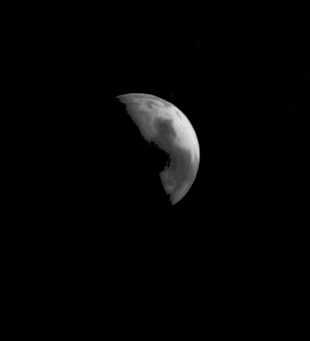
The Mars Observer took this image of Mars while the planet was still 5.8 million kilometers (3.6 million miles) away. This photograph was taken by the spacecraft's high-resolution, narrow-angle telescope on July 26, 1993, 28 days before Observer was to begin orbiting Mars. Even from this distance, you can see the Hellas impact basin, a bright roughly circular area toward the bottom of the picture. You can also see Syrtis Major, a region of volcanic plains and sand dunes. It appears here as the dark area in the center of the frame.
As some scientists speculate, high winds may be common in Hellas, and thus it might be difficult to land a spacecraft there, but its landscape would be interesting to explore. Indeed, humans might consider landing in Hellas because the atmospheric pressure is highest at low elevations, and thus there is more atmosphere to slow the descent of a landing spacecraft. As Mars explorers, students should prepare a profile map of Hellas to discover how steep its crater walls would be to climb. How can students discover how steep a surface is from a profile map? This activity helps students answer this question.
Distribute materials, circulate among student groups and encourage them to:
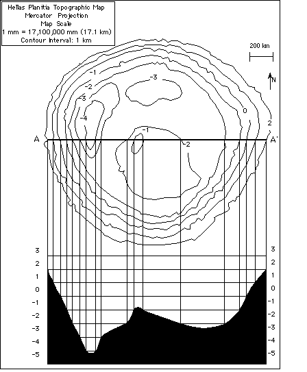


The deepest place on Earth is -11,034 meters below sea level in the Mariana Trench of the western Pacific Ocean. Hellas basin has the lowest elevation on Mars (less than 4,000 meters). It therefore has the greatest thickness of atmosphere above its crater floor and would have the greatest amount of air pressure on Mars. It is covered by bright frost in the southern hemisphere winter and is usually the site of vigorous dust storms during the summer. If the materials on the floor of Hellas include lake sediments, what might be the implications for Mars explorers?
The rim of the immense, weathered Hellas impact basin is pitted by ancient craters. This has led scientists to conclude that Hellas formed billions of years ago. Its floor (the plains or planitia), on the other hand, does not have as many craters on it, which suggests that it is younger. An understanding of the physical properties of materials on the floor of this impact crater could help us address fundamental questions about Mars' history. New radar data suggests that Hellas Planitia is a "stealth" feature. That is, it has no radar return. This means that the plains of Hellas do not have many exposed rocks, and its surface sediments could be fine dust and sand. If there were exposed rocks, the new radar data would have had a clear radar signal returned.
You can use three-dimensional maps of Mars to help students visualize topography from a two-dimensional map. Students can make a three-dimensional model of Hellas and compare it with their profile. To create the three-dimensional model, students should cut out the contour lines of Hellas and trace these contour shapes onto cardboard. Each contour line will have its own sheet of cardboard. Students will cut out the individual cardboard contours and glue them together in a stack to form their model. It is difficult to cut cardboard, but the finished model is worth the effort. To create a large three-dimensional model of the planet, enlarge the western and eastern hemispheres maps and cut out the squares bounded by the longitude and latitude lines. Note that the map scales will change when the maps are enlarged. Use the scale bars to determine the new map scales. There will be 24 squares that you can assign to student teams or individuals. Student teams can then combine their squares to create a map of Mars that depicts the area from 60 degrees north to 60 degrees south.It will not be possible to show the relative heights of the volcanic peaks with this scale, but students can paint these onto the model. The Planetary Society map "An Explorer's Guide to Mars" (see "MarsLink Resources") is an excellent classroom aid for this activity.